To guarantee project success, the building sector has traditionally depended on exact planning and effective monitoring. Aerial mapping has become a revolutionary tool for building site planning and monitoring with the fast development in drone and satellite technologies। Aerial mapping is altering how building projects are addressed, managed, and carried out from site surveys to real-time progress tracking.
Site mapping’s development in construction
Construction site mapping has long depended mostly on hand surveys, which sometimes required large amounts of time and money. Survey teams would use ground-based tools, including total stations, theodolites, and GPS receivers, over days or sometimes weeks, gathering data. Although efficient, this approach was prone to human mistakes and delays, especially in remote or large-scale sites.
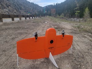
Data collecting has been greatly sped up by the combination of aerial mapping done by drones and satellite images. Aerial mapping gives high-resolution photos and 3D models that offer thorough insights well beyond what conventional techniques can produce, since it allows one to record vast areas in one flight. This change enables building teams to make judgments with more speed and accuracy, so guiding their activities.
Increased Precision and Accuracy
Aerial mapping offers, among its main advantages, more accuracy and precision in collecting topographical and geographical data. Accurate 3D terrain models, contour maps, and orthophotos can be created from drones fitted with LiDAR, photogrammetry sensors, or multispectral cameras. Crucially important during the planning process are elevation changes, drainage patterns, and natural impediments seen in these data sets.
Precise topographic data helps planners and engineers create more effective layouts, lower grading costs, and prevent unanticipated difficulties during foundation or excavation work. It also facilitates improved environmental impact studies and utility location. Data’s precision lowers rework, saves money, and raises general building efficiency.
Simplified Pre-Building Design
Building teams must have a thorough awareness of the project site before they start building. Rapid site research made possible by aerial mapping helps teams evaluate land conditions, spot any risks, and decide where best to develop. Seeing the location from above helps one to clearly see how the project will interact with its surroundings.
Aerial images can also be blended with 3D models and architectural blueprints to produce visual simulations of the ultimate construction. Presenting to clients and internal planning both benefit from these simulations. They also help with obtaining required licenses since regulatory authorities of regulations are more inclined to approve ideas supported by accurate and comprehensive visual documentation.
Better Project Tracking and Monitoring
Aerial mapping is very valuable for tracking and recording project development once building starts. High-resolution photos and videos of the site can be obtained by regular drone flights, which can subsequently be matched with past data sets to monitor evolution over time. Early identification of bottlenecks, measurement of output, and detection of differences are made simpler by this graphic record.
Monitoring development via aerial data also helps stakeholders to communicate more effectively. Remote view of current site conditions by project managers, architects, and clients helps to speed decision-making and lessen the need for frequent on-site inspections. These images can also help to guarantee adherence to project budgets and schedules, therefore lowering delays and preventing cost overruns.
Improved risk control and safety
In construction, safety comes first, hence, aerial mapping helps to establish safer job areas. Drones can reach difficult-to-reach or hazardous regions, therefore lessening the need for people to approach potentially harmful zones. This reduces the possibility of mishaps and injury throughout surveys and site visits.
Real-time monitoring of safety compliance may also be accomplished via aerial mapping. Project managers can spot dangerous habits or conditions, such as missing safety barriers or inadequately kept equipment, and take quick care of them. Aerial mapping enables building teams to keep a safer and more under control work environment by aggressively controlling hazards.
Compliance with Environmental Impact Assessments
Environmental rules are getting stricter, and building projects are frequently subject to thorough environmental studies. Aerial mapping offers current images and data that may be examined to determine possible environmental effects, therefore facilitating these assessments. This includes tracking of vegetation, monitoring of water runoff, and identification of protected areas for preservation.
Construction teams can design erosion control plans, track air and water quality, and guarantee environmental guideline compliance using aerial data. This proactive strategy not only helps avoid regulatory fines but also supports sustainable building methods, which are ever more crucial to investors and communities both.
Time and Financial Efficiency
Using aerial mapping technology drastically lowers the time and expense involved with more conventional survey techniques. In a fraction of the time it would take a ground team, a single drone flight may cover large areas; the data gathered can be handled and examined in hours. This quick turnaround lowers project delays, quickens decision-making, and accelerates planning.
Regarding financial savings, aerial mapping’s efficiency reduces the need for surveying by means of fewer labor hours and lowers the chance of expensive mistakes. Precise measurements and real-time updates help to decrease rework, material waste, and building conflicts. Through these total savings throughout the length of a project, the investment in aerial technology usually pays for itself.
Working using Construction Management Software
For project management, modern building projects depend more and more on digital platforms; aerial mapping data fits many of these technologies rather naturally. Building Information Modeling (BIM) systems or Geographic Information Systems (GIS) may import site maps, point clouds, and 3D models into a consistent perspective of the project.
More precise scheduling, resource allocation, and progress reporting made possible by this integration help. By comparing planned against actual performance, it also helps teams to make data-driven changes that support predictive analytics. Aerial mapping thus becomes a necessary part of a totally computerized building process.
Prospect and Innovation Future
Aerial mapping’s possible uses in building will only expand as drone and satellite technology develop. Real-time drone-to-cloud processing, artificial intelligence-powered picture analysis, and autonomous flying planning are among the innovations making airborne data collecting, interpretation, and application simpler.
Thermal imaging and multispectral sensors could also help building teams track material performance, find heat leaks, and evaluate energy efficiency both during and following construction. Aerial mapping is expected to become even more essential to the building sector as long as innovation is driven forward.
Finally,
In building site planning and monitoring, aerial mapping has brought in a fresh period of efficiency, safety, and accuracy. Replacing labor-intensive and antiquated survey techniques helps building experts to work safely, plan better, and build faster. As the technology develops, it will change the building scene even more and provide more possibilities for the development of infrastructure in modern society.