The Atlas Mountains stretch across North Africa like a rugged backbone, shaping the geography, climate, and culture of Morocco, Algeria, and Tunisia. Understanding this vast range becomes much easier when you break it down through a clear atlas mountains map, which reveals how the terrain is divided into distinct regions, marked by towering peaks, and crossed by historic routes.
Overview of the Atlas Mountain System
The Atlas Mountains extend over 2,500 kilometers, forming a natural barrier between the Mediterranean coast and the Sahara Desert. When studying an atlas mountain map, you’ll notice that the range is not a single continuous chain but a series of sub-ranges with unique landscapes and characteristics.
These mountains influence weather patterns significantly. Northern slopes receive more rainfall, making them greener and more fertile, while southern slopes transition into arid desert conditions. This contrast is one of the most fascinating aspects visible on any detailed map of the region.
Main Regions of the Atlas Mountains
1. High Atlas
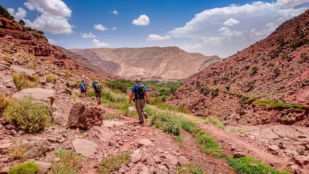
The High Atlas is the most prominent and highest section of the range, located primarily in Morocco. It is often referred to as the “roof of North Africa.” On an Atlas Mountains map, this region stands out due to its elevation and central location.
This area is home to dramatic peaks, deep valleys, and traditional Berber villages. Snow covers many higher elevations during winter, making it distinct from the surrounding desert landscapes.
2. Middle Atlas
Situated north of the High Atlas, the Middle Atlas features rolling plateaus, cedar forests, and more moderate elevations. On the map, it appears as a transition zone between rugged high mountains and coastal plains.
This region is known for its biodiversity, including forests of cedar trees and wildlife such as Barbary macaques. Compared to the High Atlas, it is less extreme but equally important in understanding the mountain system.
3. Anti-Atlas
South of the High Atlas lies the Anti-Atlas, a much older and more eroded mountain range. When viewing an atlas mountains map, this region appears closer to the Sahara, with lower elevations and a more desert-like environment.
The Anti-Atlas is rich in mineral resources and features striking rock formations shaped by centuries of erosion. It offers a quieter, less-traveled landscape compared to the more popular High Atlas.
4. Saharan Atlas
Extending into Algeria, the Saharan Atlas forms a barrier along the northern edge of the Sahara Desert. On maps, it appears as a dividing line between fertile northern regions and the vast desert.
This region is less visited but plays a crucial role in climate separation and water distribution across the area.
5. Tell Atlas
The Tell Atlas runs parallel to the Mediterranean coast in Algeria and Tunisia. It is greener and more temperate than other parts of the range. On an atlas mountains map, it lies closer to the sea and is often associated with agriculture and population centers.
Notable Peaks in the Atlas Mountains
Mount Toubkal
Mount Toubkal is the highest peak in North Africa, standing at 4,167 meters. It dominates the High Atlas and is clearly marked on any atlas mountains map. This peak attracts hikers and climbers from around the world due to its accessibility and stunning views.
Mount M’Goun
The second-highest peak in Morocco, Mount M’Goun reaches over 4,000 meters. It is located in the High Atlas and is known for its long ridge walks and scenic valleys.
Mount Sirwa
Situated between the High Atlas and Anti-Atlas, Mount Sirwa is a volcanic peak. Its position on the map highlights its role as a geological transition point between different mountain systems.
Important Routes Through the Atlas Mountains
Tizi n’Tichka Pass
One of the most famous mountain passes in Morocco, Tizi n’Tichka, connects Marrakesh to Ouarzazate. On an atlas mountains, it is a key route cutting through the High Atlas.
This pass is known for its winding roads, dramatic scenery, and elevation of over 2,200 meters. It has been used for centuries as a trade route linking inland regions with desert areas.
Tizi n’Test Pass
Another important crossing, Tizi n’Test, connects Marrakesh to the Souss Valley. It is less traveled than Tizi n’Tichka but offers equally breathtaking views.
Road of a Thousand Kasbahs
Although not a single pass, this route runs along the southern edge of the High Atlas. On the map, it follows river valleys and connects historic fortified villages known as kasbahs.
Trans-Atlas Routes
Several modern highways and traditional trails cross the Atlas Mountains, linking cities and rural communities. These routes are essential for trade, tourism, and local travel.
How to Read an Atlas Mountains
Understanding the Atlas Mountains involves more than just identifying locations. Here are a few key elements to focus on:
Elevation markings help distinguish between high peaks and lower plateaus
Color gradients often show vegetation levels and climate zones
Route lines indicate roads, trails, and passes
Water features such as rivers and valleys reveal how water flows through the mountains
By interpreting these features, you can better understand how geography shapes life in the region.
Cultural and Geographic Significance
The Atlas Mountains are not just a physical feature; they are home to diverse communities with rich traditions. Berber (Amazigh) cultures have thrived here for centuries, adapting to the challenging terrain.
Maps of the region also reveal how settlements are often located near water sources and valleys, highlighting the importance of geography in daily life. Trade routes marked on an atlas mountains morocco reflect historical connections between different regions.
Why the Atlas Mountains Matter
The Atlas Mountains play a crucial role in North Africa’s environment. They act as a climate barrier, influence rainfall patterns, and support agriculture in surrounding areas.
From a mapping perspective, they provide insight into how natural features shape human activity. Whether you are a traveler, a student, or a geography enthusiast, studying this region with a detailed map enhances your understanding of its complexity.
Conclusion
Exploring the Atlas Mountains through a well-detailed map reveals a world of diversity, from towering peaks like Mount Toubkal to expansive regions such as the High Atlas and Anti-Atlas. Routes winding through these mountains tell stories of trade, travel, and survival across centuries.
By analyzing regions, peaks, and pathways, an atlas mountains map becomes more than just a visual tool, it becomes a guide to understanding one of North Africa’s most remarkable landscapes.