Land Market Analysis
Undervalued land exists in every market. It is not necessarily land in a struggling area or land with obvious problems. It is land whose asking price does not yet reflect what the market evidence, read carefully at the parcel level, would actually support. Identifying it requires more than browsing listings at face value. It requires a comparison between what a parcel is priced at and what the data says it is worth.
Parcel-level market data makes that comparison possible at scale. Rather than relying on the seller’s pricing rationale or surface-level comparisons with neighboring listings, a buyer who works from transaction data, ownership records, and parcel characteristics can identify pricing gaps that other buyers in the same market are missing.
What Undervalued Land Actually Means
Undervalued land is not the same as cheap land. A cheap parcel priced at $2,000 per acre may be accurately priced given its access constraints, zoning restrictions, and environmental limitations. An undervalued parcel priced at $5,000 per acre may be meaningfully below the $8,000 per acre that recent comparable sales in the same county and land use category have established as the market rate.
The distinction matters because undervalued land represents a genuine pricing inefficiency, a gap between asking price and supportable market value, rather than simply a low asking price. Finding undervalued land means finding parcels where the price does not yet reflect what the evidence shows, and where the evidence can be verified before an offer is made.
Pricing inefficiencies in land markets arise from several consistent sources. Absentee ownership, where the owner lives far from the parcel and has not tracked local market appreciation, is one of the most reliably documented. Inherited parcels being sold by heirs who base pricing on assessed value or original purchase price rather than current comparable transactions is another. Long-stale listings that were priced accurately several years ago but have not been updated to reflect subsequent market movement are a third.
The Role of Comparable Sales in Identifying Pricing Gaps
The foundation of undervalued land identification is comparable sales research. A buyer who knows what similar parcels, matched by acreage range, land use type, access characteristics, and geographic proximity, have actually transacted for in the preceding twelve months has a pricing baseline against which any listing can be evaluated.
Comparable sales research for land is more complex than for residential real estate because land transactions are not universally recorded in a standardized database. County recorder deed records, aggregated parcel transaction databases, and in some markets MLS data for land listings are the primary sources for recent comparable transactions. Building a reliable comparable set requires filtering correctly: the same county, the same land use classification, a comparable acreage range, and similar access and infrastructure characteristics.
For buyers who want to understand the methodology for building a defensible comparable set for land, the guide to comparable land sales methodology provides a useful overview.
Parcel-Level Characteristics That Create Pricing Gaps
Beyond comparable sales analysis, specific parcel-level characteristics consistently produce pricing gaps that attentive buyers can identify before making an offer.
Long Ownership Tenure Without Recent Activity
Parcels held by the same owner for ten or more years without any recent improvements, leases, or transaction activity are statistically more likely to be priced below current market levels. Long-tenured owners often set asking prices based on their original cost basis, their assessed value, or informal market impressions rather than current comparable transaction data. A parcel that has appreciated significantly in a growing corridor over a decade but whose asking price has not been updated accordingly is a classic source of undervaluation.
Absentee Ownership
When the owner’s mailing address differs from the parcel’s location, the owner is not actively using or monitoring the land. Absentee owners are less likely to track local market appreciation, less likely to receive updates from a local agent, and more likely to price based on outdated information. County assessor records make absentee ownership identifiable from the ownership and mailing address fields in the parcel record.
Irregular Shape or Apparent Constraints
Parcels with irregular shapes, non-standard dimensions, or apparent access constraints are frequently priced below market by sellers who assume the constraints reduce buyer interest significantly. In some cases, those constraints do materially limit value. In others, the constraint is either resolvable or less significant than the seller’s pricing implies. A buyer who investigates the actual access situation, zoning, and usability of an irregular parcel before dismissing it may find that the market discount exceeds the actual limitation.
Land in the Path of Growth That Has Not Yet Been Repriced
Land in areas where infrastructure investment has been announced or population growth is accelerating may still be priced at historical levels if the seller has not tracked the trajectory of demand in the surrounding area. Comparing the parcel’s asking price against recent comparable sales in the same corridor, rather than against regional averages, often reveals whether the asking price reflects current conditions or lags behind them.
How Parcel Data Accelerates the Search
The challenge with identifying undervalued land has historically been scale. Running a comparable sales analysis and reviewing ownership tenure, mailing address, and parcel characteristics for dozens of candidate parcels is a significant manual research effort when conducted parcel by parcel across separate county portals.
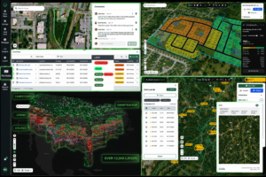
Parcel-level databases that aggregate assessor records, transaction history, ownership data, zoning, and environmental layers across multiple counties into a single searchable interface make it possible to apply these screens systematically across a target geography rather than one parcel at a time. A buyer who can filter a county’s parcel records by ownership tenure, absentee owner status, land use type, and acreage range, and then cross-reference those results against recent comparable sales data, is running a systematic undervaluation screen rather than a manual search.
Buyers who want to apply this type of systematic parcel screening to identify pricing gaps in their target market can screen land markets using parcel data.
For buyers who also want to see parcel boundary configurations as part of their assessment, parcel boundary maps and plat data can provide additional context.
What to Verify Before Acting on a Pricing Gap
A parcel whose asking price appears below comparable sales data is not automatically a good acquisition. The pricing gap may reflect information the comparable sales do not capture: a title defect, an access problem not visible on the assessor record, an environmental constraint, or a deed restriction that limits the parcel’s usability below what the comparable parcels support.
Before acting on any identified pricing gap, buyers should confirm that the parcel has documented legal access, that the title history is clean, that no encumbrances limit its intended use, and that the comparable sales being used as a pricing benchmark genuinely match the subject parcel’s characteristics. A pricing gap verified against those checks is a genuine opportunity. A pricing gap that has not been verified may be a signal that other buyers have already identified the problem and priced around it.
Conclusion
Undervalued land is identifiable through systematic parcel-level research rather than intuition or surface-level browsing. Comparable sales analysis, ownership tenure review, absentee owner identification, and access and encumbrance verification together produce a framework for finding pricing gaps before other buyers in the same market do. For buyers who want to understand how land values vary across counties and what the market evidence says a specific parcel type is worth, how to determine land value provides a useful starting point.