Traveling through Morocco offers an unforgettable blend of culture, landscapes, and adventure. One of its most striking natural features is the Atlas Mountains, a vast system that stretches across the country and into neighboring regions. For travelers, understanding a map of Morocco Atlas Mountains is essential to planning a smooth and enriching journey.
Overview of the Atlas Mountains
The Atlas Mountains span roughly 2,500 kilometers across North Africa, cutting through Morocco, Algeria, and Tunisia. In Morocco, they form the backbone of the country’s geography, separating the Atlantic and Mediterranean coastlines from the Sahara Desert.
There are three main sections travelers should know:
- High Atlas – The tallest and most famous range
- Middle Atlas – Known for forests and cooler climates
- Anti-Atlas – More arid and less visited
Each region offers a different experience, and a good map of Morocco Atlas Mountains helps you visualize how these areas connect.
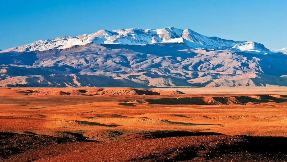
High Atlas: The Roof of North Africa
The High Atlas Mountains are often the highlight for visitors. This region is home to Mount Toubkal, which rises to 4,167 meters. Most trekking routes and adventure tours are centered here.
On a map, the High Atlas appears as a dense, rugged spine running diagonally across central Morocco. Key access points include:
- Marrakech – the main gateway for tourists
- Imlil – starting point for treks
- Ourika Valley – popular for day trips
Travelers using a map of Morocco Atlas Mountains will notice that roads here wind through dramatic passes, making distances seem short but travel times longer.
Middle Atlas: Forests and Lakes
North of the High Atlas lies the Middle Atlas, a region often overlooked but equally rewarding. This area is greener, with cedar forests, rolling hills, and lakes.
Important spots include:
- Fes – a cultural hub nearby
- Ifrane – known as “Little Switzerland”
- Azrou – famous for wild monkeys
On a map, the Middle Atlas looks less rugged and more spread out than the High Atlas. It’s ideal for relaxed travel, scenic drives, and wildlife encounters.
Anti-Atlas: Gateway to the Desert
Further south, the Anti-Atlas Mountains form a transition zone between the higher peaks and the Sahara. This region is drier, quieter, and less frequented by tourists.
Key locations include:
- Agadir – a starting point for exploration
- Tafraoute – known for unique rock formations
- Tiznit – famous for silver jewelry
When looking at a map of Morocco Atlas Mountains, the Anti-Atlas appears more fragmented, with lower peaks and desert landscapes.
Understanding Travel Routes
A major advantage of studying a map before your trip is understanding how routes connect different regions. Morocco’s mountain roads are scenic but can be challenging.
Important routes include:
- The Tizi n’Tichka Pass, linking Marrakech to Ouarzazate
- Roads connecting Fes to the Middle Atlas towns
- Southern routes leading toward the Sahara Desert
These routes often zigzag through mountains, so distances on a map don’t always reflect travel time. Planning ahead is crucial.
Climate and Elevation on the Map
Another important feature of any map is elevation. The Atlas Mountains vary dramatically in height, which directly affects climate.
- High Atlas: Snow in winter, cool summers
- Middle Atlas: Mild temperatures, occasional snow
- Anti-Atlas: Warm and dry year-round
Understanding elevation on a map of Morocco Atlas Mountains helps travelers pack appropriately and plan seasonal activities like trekking or skiing.
Cultural Regions Within the Mountains
The Atlas Mountains are not just about landscapes—they are also home to diverse communities, especially the Berber (Amazigh) people.
Different areas on the map correspond to unique cultural experiences:
- High Atlas: Traditional villages and trekking culture
- Middle Atlas: Agricultural communities and forests
- Anti-Atlas: Desert-edge settlements and crafts
A map can guide you toward regions where you can experience authentic local life, far from crowded tourist centers.
Tips for Using a Map Effectively
When exploring the Atlas Mountains, relying solely on GPS is not always enough. Here are practical tips:
- Carry both digital and physical maps
- Note elevation changes and road conditions
- Identify fuel stops and towns in advance
- Mark trekking routes clearly
A detailed map of Morocco Atlas Mountains becomes an essential travel companion, especially in remote areas.
Best Time to Travel Based on the Map
Your map can also help determine the best time to visit different regions:
Spring (March–May): Ideal for most
Summer: Best for higher elevations
Autumn: Great for trekking
Winter: Snow in High Atlas, limited access in some areas
By matching locations on your map with seasonal conditions, you can optimize your itinerary.
Final Thoughts
The Atlas Mountains are one of Morocco’s most captivating features, offering everything from snow-capped peaks to desert landscapes. Understanding how to read and interpret a map of Morocco Atlas Mountains allows travelers to move confidently between regions, discover hidden gems, and plan efficient routes.
Whether you’re trekking to Mount Toubkal, exploring cedar forests, or venturing toward the Sahara, a well-understood map transforms your journey from a simple trip into a deeply rewarding adventure.